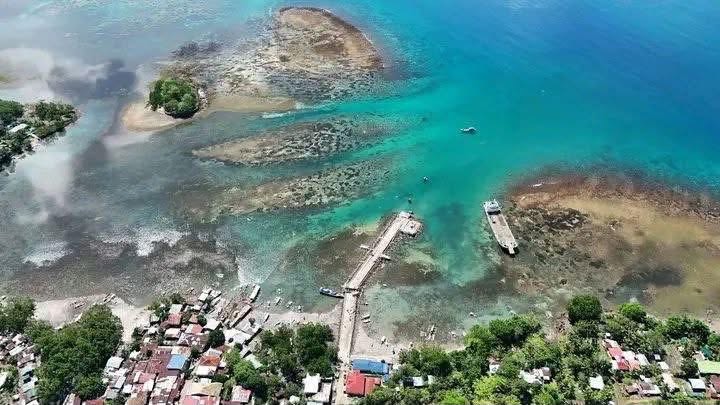
BALUT ISLAND, DAVAO OCCIDENTAL — Large sinkholes and unusual coastal changes have been reported in Balut Island and several parts of southern Mindanao in the aftermath of the powerful magnitude 7.8 earthquake that struck offshore Sarangani on June 8, raising concerns among residents and experts monitoring the region’s geological conditions.
Photos and videos circulating online show massive sinkholes and areas of apparent ground subsidence, with residents describing the formations as alarming and unlike anything they had previously witnessed. Some communities also reported that seawater has yet to return to its normal level days after the earthquake, fueling concerns about ongoing changes to the landscape.
Experts believe the phenomenon may be linked to land displacement and shifts in the Earth’s crust triggered by the strong seismic event. Ground deformation, coastal uplift, subsidence, and the formation of sinkholes are among the geological effects that can occur following major earthquakes.
Authorities and geologists continue to assess the affected areas to determine the extent of the environmental impact and identify potential risks to nearby communities. Residents have been advised to avoid areas showing visible ground cracks, unstable terrain, or newly formed sinkholes until further evaluations are completed.
The magnitude 7.8 earthquake, one of the strongest to hit Mindanao in recent years, caused significant damage to homes, infrastructure, and coastal communities across several provinces in southern Philippines. Officials continue to monitor aftershocks and related geological hazards as recovery efforts remain underway.
Photos: Andrew Hubac, Pangga Rose Fausto, Randolph

Comments